The Glasgow Central Railway - Botanic Gardens
The Glasgow Central Railway ran mostly underground from Stobcross Junction (now Exhibition Centre), up the valley of the River Kelvin, to Maryhill. There were stations at Kelvinbridge, Botanic Gardens, Kirklee and Maryhill Central.
Stobcross northwards

National Library of Scotland's 1892-4 1:500 map of Stobcross![]()
Kelvinbridge

National Library of Scotland's 1:500 map of Kelvinbridge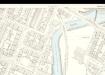
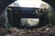
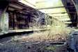
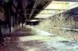
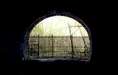
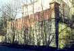
Under Great Western Road
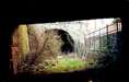
with some detail for the real brickwork aficionados !
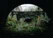
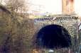
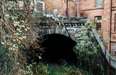
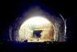
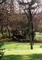
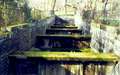
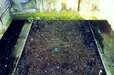
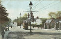
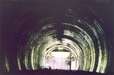
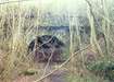
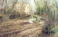
Botanic Gardens
![[Botanic Gardens station]](.thumb_botanic11.jpg "Botanic Gardens station - general view")


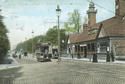
| Links to The Glasgow Story : Botanic Gardens in 1906 | |
 |
 |
National Library of Scotland's 1:500 map of 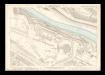 Botanic Gardens
Kirklee
Relevant Links
RailScot on the Glasgow Central Railway.
![]() The Underworld has the
original engineering drawings for the line.
The Underworld has the
original engineering drawings for the line.
A comprehensive chronology of Glasgow's Railways.
Hidden Glasgow's pictures of Botanic Gardens
Scottish Metal (formerly Downward Spiral) on Botanic Gardens.
Urbanadventure.org on Botanic Gardens station (an excellent website, now sadly deleted).
![]() Leverton.org on Glasgow London Road
Leverton.org on Glasgow London Road
![]() You could also see what Google has to say ...
You could also see what Google has to say ...